The recordings of the TheHuT–WG8 joint workshop on “Real-time Monitoring Using IoT Technology“, held on May 7 2024, are online on the LandAware YouTube Channel.
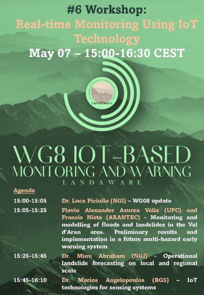
The recordings of the TheHuT–WG8 joint workshop on “Real-time Monitoring Using IoT Technology“, held on May 7 2024, are online on the LandAware YouTube Channel.
Recording of the WG5 meeting of 25 June 2024
Topic: Landslide susceptibility and road-network connectivity by means of Machine Learning
Joshua Dimasaka (Cambridge University, Centre for Risk in the Built Environment) presented his work on how landslide susceptibility and the associated road-network connectivity can be calculated with Machine Learning. And he showed a very illustrative application of his methods to the case of Norway.
The recorded presentation is available on our YouTube channel:

The recordings of the webinar by NASA and Pacific Disaster Center on Landslide Hazard Awareness held on April 11, 2024 (info here) can be found on the LandAware YouTube channel:
The webinar “Landslide Hazard Awareness – NASA and Pacific Disaster Center cooperation to support decision-making” is scheduled for April 11, 2024 in the following time slots:
1:00 p.m-2:30 p.m. (EST)
11:00 a.m. 12:30 p.m. (Centro América)
7:00 p.m.-8:30 p.m. (CEST)
To join the webinar use the following link
Key objectives:
Present Research Findings and showcase the partnership between NASA and the Pacific Disaster Center (PDC) in leveraging advanced technologies and data to improve landslide hazard assessment and decision-making processes. Introduce participants to the various tools, platforms, and resources developed through the collaboration between NASA and the PDC, such as landslide risk maps, and decision support tools.
Expected outcomes:
At the end of the webinar, it is expected that participants will have gained a better understanding of the actions and strategies implemented by the organizations involved in the region and that concrete opportunities for future collaboration will have been identified. In addition, it seeks to foster a renewed commitment to risk reduction and resilience in Central America.
Expected audience:
The webinar is open to all LandAware associates in particular those from the LatinAmerica region or working with landslide early warning systems in the region. The webinar is aimed in particular at the network on landslides in Central America made up of experts from official institutions in Central American countries, such as INSIVUMEH of Guatemala, INETER of Nicaragua, SGR of Costa Rica, SINAPROC of Panama, COPECO of Honduras, and MARN of El Salvador.
Next steps – After the webinar:
A monitoring process will be carried out that will include preparing a report with the conclusions and recommendations that emerged during the event. In addition, the possibilities of establishing working groups or joint projects will be explored to advance risk reduction in the region.
Organizers:
Ricardo Quiroga: NASA Disasters Coordinator
Graziella Devoli: LandAware EC member/Norwegian Water Resources and Energy Directorate (NVE)
Presenters:
Thomas Stanley LinkedIn
Greg Hampe LinkedIn
Robert Emberson LinkedIn
Duration: 90 minutes
Agenda:
NEWS received from
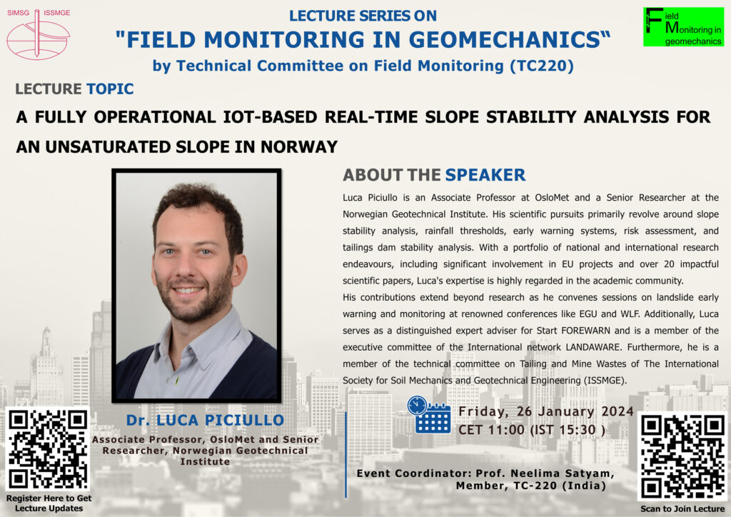
Luca Piciullo (NGI, Norway)
The next International Society for Soil Mechanics and Geotechnical Engineering (ISSMGE) – TC220 Field Monitoring in Geomechanics series of international lectures will take place on Friday 26th of January 2024 at 11:00 CET. It will be given by Dr. Luca Piciullo, with a lecture on “A fully operational IoT-based real-time slope stability analysis for an unsaturated slope in Norway”. This is the fifth in this very successful series of lectures.
The lecture will be introduced by Dr. Neelima Satyam.
To join the lecture, please use the following link: https://lnkd.in/g8Cn_W2D or scan the QR code.
The recording of the presentation on the failure prediction and hazard management of the “Insel” rockslide compartment at Brienz/Brinzails (Eastern Switzerland) held on 18 January 2024 by Simon Löw is online on the LandAware YouTube channel.