The recordings of the WG5 webinar by Luca Ciabatta on “Soil moisture-based thresholds for the assessment of landslide hazard”, held on 20 September 2024, are available on the LandAware YouTube channel:
LandAware WG5 meeting 20 September 2024, 3 p.m. CEST
Luca Ciabatta from the Research Institute of Geo-Hydrological Protection (IRPI) of the National Research Council (CNR), Perugia, will present his recent work on
Soil moisture-based thresholds for the assessment of landslide hazard.
Summary: The Civil Protection Service of Umbria Region, central Italy, developed a landslide early warning system based on soil moisture conditions and rainfall over the regional territory. By identifying the degree of saturation before and after the rainfall event (obtained through a hydrological model), it has been observed that most of the activations occurred when the soil reached saturation. In this way, an alert can be issued when the amount of rainfall needed by the soil to reach saturation is observed. The proposed method is able to identify correctly most of the proposed events with a very limited amount of false alarms.
People can join the meeting with the following link:
https://wsl.zoom.us/j/61197474609?pwd=A6zFW8a5ZKA6Mk5cqMqcuw6zzvutC4.1&from=addon
NEWS received from
Ben Mirus (USGS, USA)
Dear colleagues (and apologies for any cross-posting),
We encourage you to submit an abstract to the technical session NH030: “Landslide Life Cycle: From Hazard Analysis to Risk Assessment” for the upcoming AGU Fall Meeting taking place 9-12 December 2024. This session has been running several years in a row and is the only broad session focusing specifically on landslides within the Natural Hazards section. We seek contributions that span the landslide life cycle, from understanding landslide hazards to communicating landslide science to reduce risk.
We have two invited speakers this year with unique and contrasting careers and perspectives on landslide hazards:
Professor Roy Sidle, University of Central Asia
and
Dr. Shelby Ahrendt, U.S. Geological Survey
This year’s meeting will be held both in-person in Washington, D.C., USA for those able to attend, and online with options for interactive participation. Please share this message with anyone that you might know that would be interested in submitting to this session. Session information follows, please note abstracts are due by 31 July 2024 at 23:59 Eastern U.S. Daylight Time (EDT).
Submit your abstract here.
We hope to see you there – either in person or online.
Warmest wishes,
Conveners
Ben Mirus (U.S. Geological Survey – Geologic Hazards Science Center)
Thom Bogaard (Delft University of Technology)
Luca Piciullo (Norwegian Geotechnical Institute)
Lisa Luna (U.S. Geological Survey – Geologic Hazards Science Center)
———————————
NH030: “Landslide Life Cycle: From Hazard Analysis to Risk Assessment”
Landslide events have adverse and global consequences for human health and safety, infrastructure, economic activity, and natural resources. These hazards can accompany storms, earthquakes, volcanic eruptions, and wildfires, and may shift with climate and land-use change. Landslides can also cause their own cascading consequences like tsunami or river dams. New technologies and enhanced data analysis approaches have accelerated landslide mapping, monitoring, modeling, and outreach efforts, enabling improved characterization and communication of landslide processes and their societal impacts. This session brings together contributions that span the landslide life cycle, from understanding landslide hazards to communicating landslide science to reduce risk. We welcome a wide range of contributions on topics such as characterizing, mapping, and modeling recent or historical landslide events; susceptibility and risk modeling and communication; studies of individual hillslopes or regional scale efforts; rock and soil characterization; quantifying seismic, hydroclimatic, or other triggering mechanisms; and ground-based and remote monitoring.

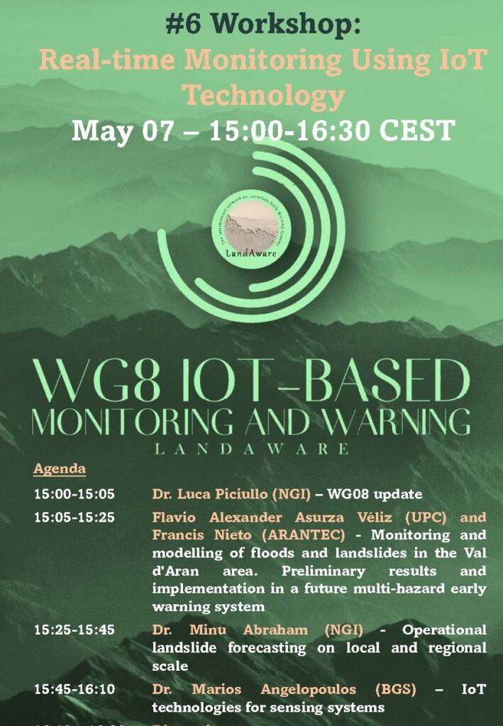
The recordings of the TheHuT–WG8 joint workshop on “Real-time Monitoring Using IoT Technology“, held on May 7 2024, are online on the LandAware YouTube Channel.
Recording of the WG5 meeting of 25 June 2024
Topic: Landslide susceptibility and road-network connectivity by means of Machine Learning
Joshua Dimasaka (Cambridge University, Centre for Risk in the Built Environment) presented his work on how landslide susceptibility and the associated road-network connectivity can be calculated with Machine Learning. And he showed a very illustrative application of his methods to the case of Norway.
The recorded presentation is available on our YouTube channel:
NEWS received from
Ugur Öztürk (Universtiy of Potsdam, Germany)
Dear colleagues,
this year, there is an exciting conference in Barcelona—the Mediterranean Geosciences Union (MedGU) annual meeting—between 25 and 28 November. It is the largest meeting dedicated to exchanging ideas on addressing critical societal and environmental challenges in the Mediterranean Region from the geoscience perspective.
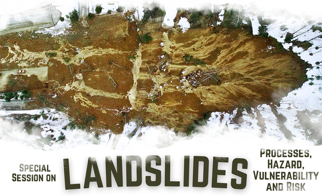
Among several engaging sessions, we (Tolga Görüm, Olivier Dewitte, Anika Braun. Ugur Öztürk) suggested one dedicated to the landslide theme (Landslides: Processes, Hazard, Vulnerability, and Risk). Among these broad themes, we want to particularly emphasize landslide prediction and early warning. Hence we invite you to submit an abstract to this special session or any other at MedGU24.
Abstract submission deadline is 30th June 2024
NEWS received from
Manfred Stähli (WSL, Switzerland)
In the next LandAware WG 5 online meeting on 25 June, 2024, 3:00-4:00 pm CEST, Joshua Dimasaka, from the Cambridge University Centre for Risk in the Built Environment, will present his work related to the real-time assessment of the exposure and physical vulnerability dynamics of settlements using Machine Learning.
Further items of the meeting will be:
- Pop-ups from the working group members (be prepared to contribute with your info to the group!)
- Info about recent and upcoming LandAware events and activities
- Outlook WG5
Welcome to join the meeting with the following link:
https://wsl.zoom.us/j/66934801469?pwd=sb9zb3QpV0XySrwb7dZk0gRV43DVS2.1
NEWS received from
Ben Mirus (USGS, USA)
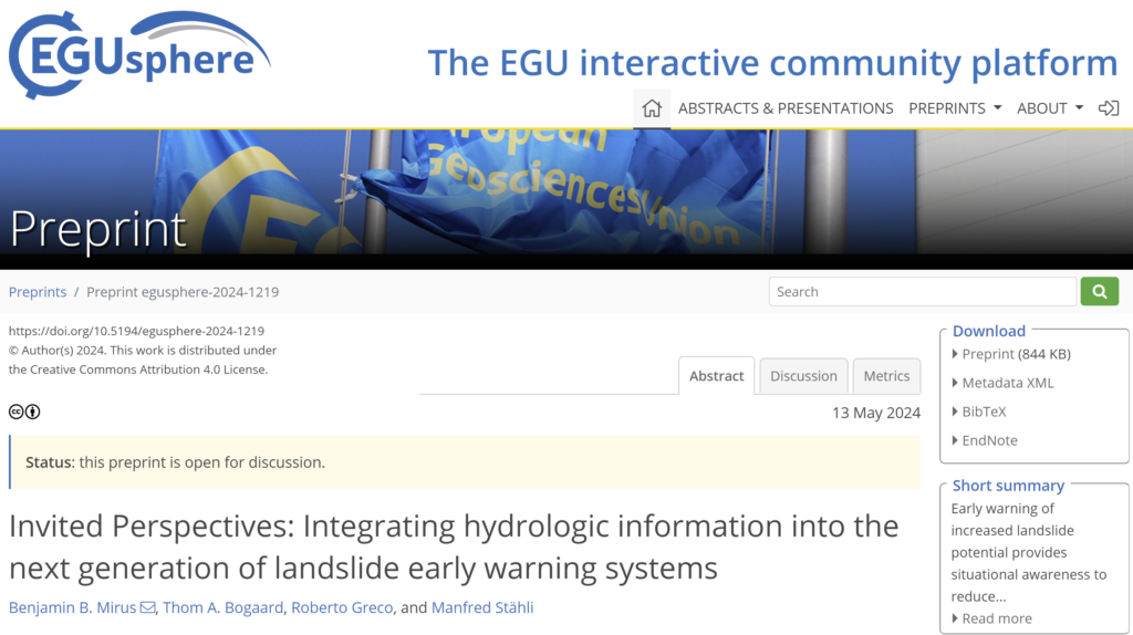
We would like to draw your attention to a new NHESS Invited Perspectives, which is now posted online. The paper focuses on lessons learned from our collective experiences with integrating hydrologic information into landslide forecasting models in different parts of the world, as well as ideas for future research needs and opportunities.
As with all EGUsphere articles, the paper is fully open access and free to read. We hope you will find it interesting and perhaps it can facilitate further discussions within the LandAware community. The preprint is open for discussion through June 24, and we would value your input whether formally or informally.
Link: https://egusphere.copernicus.org/preprints/2024/egusphere-2024-1219/

The recordings of the webinar by NASA and Pacific Disaster Center on Landslide Hazard Awareness held on April 11, 2024 (info here) can be found on the LandAware YouTube channel:
News received from
Monica Sund (NVE, Norway)
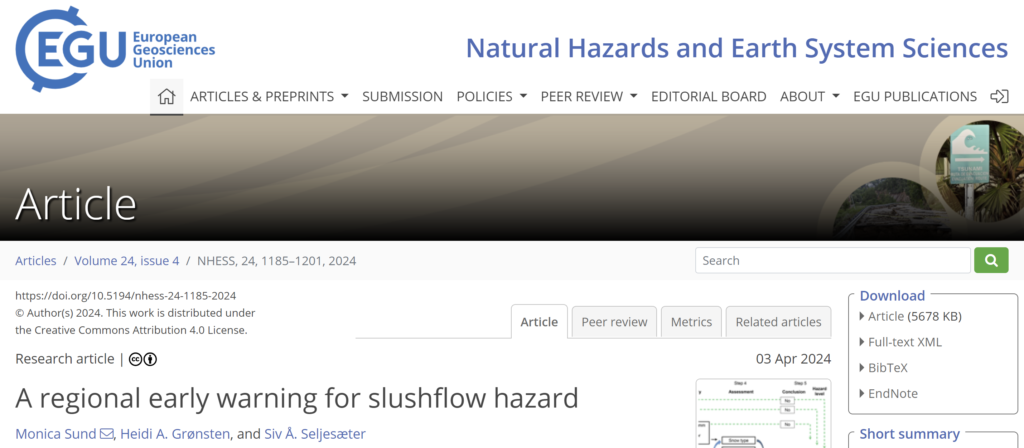
A new article entitled “A regional early warning for slushflow hazard” was recently published in the Natural Hazards and Earth System Sciences Journal.
Slushflows are rapid mass movements of water-saturated snow. They release in gently sloping locations (<30°) and are hence not restricted to steep slopes. Slushflows are observed worldwide in areas with seasonal snow cover and pose a significant natural hazard in Norway. Hazard prediction and early warning are therefore crucial to prevent casualties and damage to infrastructure.
A regional early warning for slushflow hazard was established in Norway in 2013–2014 as the first of its kind in the world. It has been operational since then. Four main variables are central in the methodology used: ground conditions, snow properties, air temperature, and water supply to snow. Gridded forecasting model simulations in the decision-making tool Varsom Xgeo, real-time data from automatic stations, and field observations from the field are assessed. Based on data from historical slushflows, a water supply–snow depth by snow type ratio has been developed as an assessment tool. This approach can be implemented in other areas with slushflow hazard where the necessary input data are available.
Reference: Sund, M., Grønsten, H. A., and Seljesæter, S. Å.: A regional early warning for slushflow hazard, Nat. Hazards Earth Syst. Sci., 24, 1185–1201, https://doi.org/10.5194/nhess-24-1185-2024, 2024.