The summary report of the LandAware Workshop 2022 is now available on the page: https://www.landaware.org/workshop2022/

The recordings of the Workshop are available on our youtube channel: https://www.youtube.com/@LandAware
The summary report of the LandAware Workshop 2022 is now available on the page: https://www.landaware.org/workshop2022/
The recordings of the Workshop are available on our youtube channel: https://www.youtube.com/@LandAware
The recordings of the LandAware Workshop 2022, held in Zürich/Birmensdorf, Switzerland, on 3-5 October 2022, are now available on our youtube channel.
NEWS received from
Mirianna Budimir (Practical Action, SHEAR)
A new publication on landslide forecasting was developed by one of the Impact and Influence projects under the FCDO and UKRI-NERC funded SHEAR programme. The title of the work is “Framework for implementation of a landslide early warning forecast model in developing countries: Challenges and lessons from SHEAR.“
Forecasting rainfall-induced landslides is a difficult yet important task that can provide time to take action to save lives, reduce economic losses and help to mitigate the impacts of landslides. The type, quality and accessibility of data directly constrain the choice of approach used for the landslide forecasting and its skill. However, in many landslide-prone countries, limited resources, and lack of investment lead to limited data availability and/or insufficient quality data for informed forecasts.
This paper collates understanding from SHEAR consortium members on key considerations for developing territorial (‘regional-scale’) landslide forecasts, particularly in developing country contexts.
The paper has been led by members from Consiglio Nazionale delle Ricerche, the British Geological Survey, the UK Met Office, and Practical Action Consulting International from the LANDSLIP project. The content of this publication has been greatly informed by discussions within LANDSLIP reflecting on project experiences through workshops within
the consortium and across the SHEAR programme.
NEWS received from
Mirianna Budimir (Practical Action, SHEAR)
Developing regional-scale landslide forecasting in two hazard-prone regions of India: the LANDSLIP project.
Over twelve per cent of the Indian land mass is prone to landslides, directly impacting settlements, roads, strategic trade corridors, and heritage sites. As part of the UKRI funded Science for Humanitarian Emergencies and Resilience (SHEAR) Programme, an international research team have co-developed a prototype regional-scale landslide forecasting system in two hazard-prone districts of India, helping authorities to improve early warning and build resilience to rainfall-triggered landslides. This research project, LANDSLIP “Landslide multi-hazard risk assessment, preparedness and early warning in South Asia: Integrating meteorology, landscape and society” research project, ran from 2016 to 2022.
The LANDSLIP consortium consisted of physical scientists, engineers, social scientists and practitioners from nine organisations in the UK, Italy, and India, including the Geological Survey of India, who are the principal government agency for landslides in India:
Through multi-agency collaboration, using interdisciplinary methodologies and perspectives and associated funding of eight PhD students, LANDSLIP has also developed new research and insights by building on existing scientific research in India, the UK and Italy.
Project outputs are aiding Indian authorities to further develop data, models, protocols and procedures to improve landslide forecasting and, in turn, support early warning.
For more information on the project, and to access resources produced by the project see:
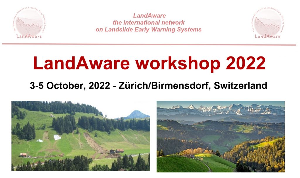
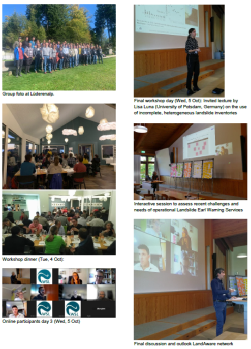
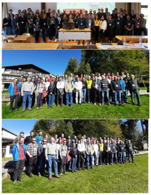
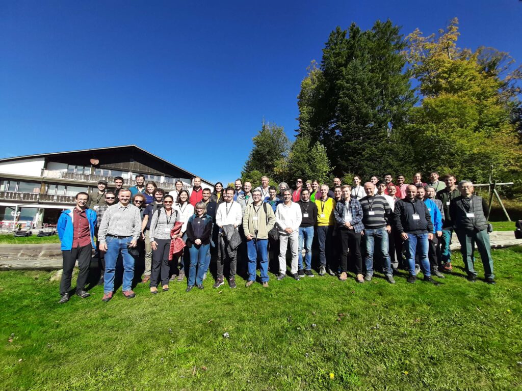
After a series of on-line events and meetings, the LandAware network for the first time will meet physically to jointly review the first two years of the LandAware network and to discuss recent developmens and current challenges in the field of landslide early warning.
The workshop will be held at the Swiss Federal Research Institute WSL in Birmensdorf, Zürich, Switzerland, in the days 3-5 October 2022.
We explicitly welcome both researchers, representatives of operational warning systems and other professionals related to landslide early warning.
Updated info at:
https://www.landaware.org/workshop2022/
NEWS received from
Jose Antonio Gili Ripoll (UPC, Spain)
On behalf of the PyrMove and GeoRisk projects, we are happy to announce four one-hour webinars on “Landslide Monitoring for Early Warning Systems” (2nd Edition), to be held this April, every Wednesday after lunchtime.
The webinar series goal is to disseminate new techniques and concepts that might help in landslide monitoring and modelling. These new solutions may be the base of some Early Warning Systems for controlling and managing the risk, in order to reduce damage or losses.
The webinars are addressed to professionals working in the risk management field, but also to the administration and public authorities responsible of the landslide and rockfall prone areas. Academics and students are also welcomed!
Webinars agenda
Wednesday, 6th of April, 2022. 15:00-16:00 (CEST)
Mixed Reality tools for visualization of complex spatial data in geomechanics – by Joan Roca (BGC Engineering)
Wednesday, 20th of April, 2022. 14:00-15:00 (CEST)
Distributed fiber optic sensing for geotechnical monitoring – by Werner Lienhart (T. U. Graz)
Wednesday, 27thof April, 2022. 14:00-15:00 (CEST)
Filling the gap between monitoring and modelling in geotechnical engineering – by Cristian de Santos (SAALG Geomechanics)
Wednesday, 4th of May, 2022. 14:00-15:00 (CEST)
Slope stability monitoring using Remote IoT Technology – by Àngela Lluch & Víctor Salines (WorldSensing)
————-
Practical directions to follow the webinars
The technical sessions will be held in English. The attendance is free. The webinars will be held online through a Google Meet session
For the first webinar (Wednesday, 6 April · 15:00) the link will be: https://meet.google.com/sif-ftdu-oxd (Meet code: sif-ftdu-oxd)
Next sessions will use a different MEET code. To be invited to one or several days, a simple pre-webinar registration is required: you must send an email to
EWS.webinars.April2021@gmail.com (the “2021” in the address is not a mistake, this gmail was configured for the 1st edition!) indicating your intention to attend to one or several webinars. You will receive the webinar link the day before each session.
In this link you may find a PDF with the factual information about the four webinars, a short description about the ‘PyrMove’ and the ‘GeoRisk’ projects and some useful links.
If you want, you can watch the four last-year webinars (April 2021) at the Youtube Webinar channel
For additional information, do not hesitate to contact the webinars ‘curators’: j.gili@upc.edu Technical University Catalonia (UPC) &
marc.janeras@icgc.cat Institut Cartogràfic Geològic Catalunya (ICGC, Barcelona, Spain)
Some of the interviews broadcast in short versions during the
LandAware MayDay round-the-clock conference.
Here are the extended versions of all interviews.
————————-
————————-
————————-
————————-
————————-
————————-
————————-
————————-
————————-