NEWS received from Manfred Stähli (WSL, Switzerland) and Ben Mirus (USGS, USA)
On February 3, 2023, a meeting of LandAware WG 5 “Innovations” addressed the role of wind speed and direction for landslide occurrence in Hurricane prone regions.
Guest speaker, Yuri Gorokhovich (Lehman College, City University of New York) illustrated how we are getting closer to predicting landslides in Hurricane prone regions in real-time using wind information.
NEWS received from Davide Tiranti (Department of Natural and Environmental Risks, Regional Agency for Environmental Protection of Piemonte – ARPA Piemonte, Italy)
A new Special Issue entitled “Geomorphological Mapping Research for Landslide” in the GeoHazards journal (MDPI) is currently open for contributions. The Special Issue is guest edited by Davide Tiranti.
Without a thorough knowledge of the landslides’ distribution on the territory you cannot lay the basis for developing a LEWS. The mapping of landslides is the first fundamental step through which it is possible to establish the relationships between landslides and the territorial and climatic variables responsible for their triggering and evolution. The purpose of this Special Issue is to collect scientific works aimed at mapping landslides and the applications that derive from them, such as the production of inventory maps, susceptibility maps, hazard/risk maps, urban planning, and the development of tools in a GIS environment aimed at collecting, processing, analysis, visualization and dissemination of landslide data.
If you are interested in submitting your manuscripts to the SI, but your institution does not fund the open access publication, please contact Davide Tiranti toget a 100% APC discount (a maximum of 10 discounts are available).
NEWS received from Manfred Stähli (WSL, Switzerland)
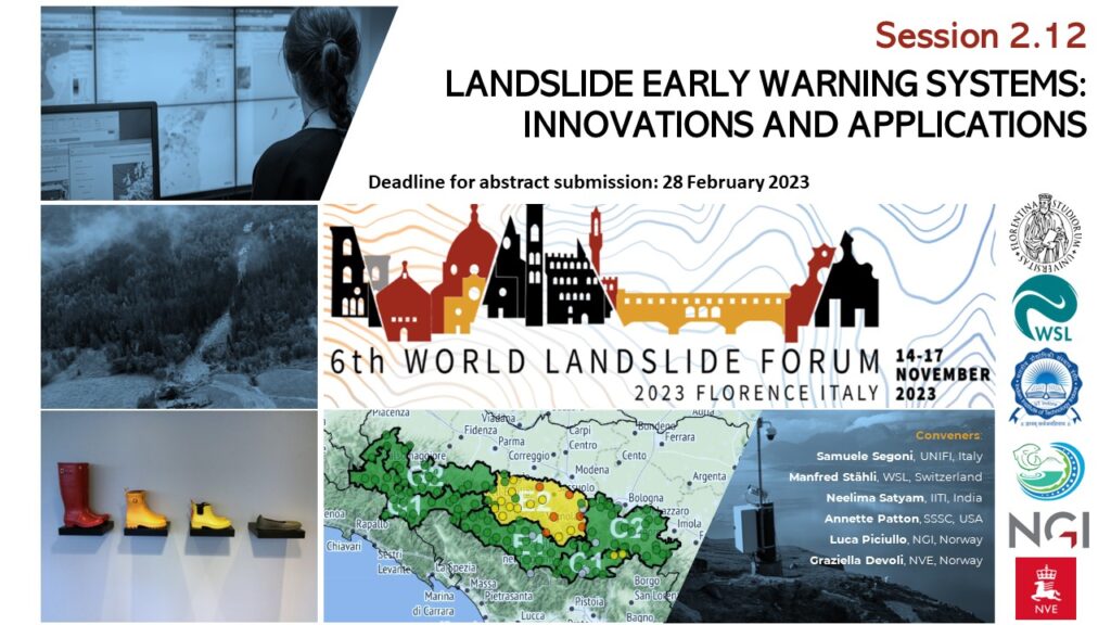
We would like to draw your attention to the session 2.12. “LANDSLIDE EARLY WARNING SYSTEMS: INNOVATIONS AND APPLICATIONS” which is scheduled in the program of the 6th World Landslide Forum (Florence, Italy, 14-17 November 2023).
The session is open to contributions from researchers, agencies, decision-makers and practitioners and intends to cover every topic connected with LEWS, at every scale: methodological innovations, technical advances, operational implementations, reliability evaluation, documentation of case studies, communication strategies, social perception of warnings and management of uncertainties.
You can read the complete description of the session here, and submit your abstract at https://wlf6.org/submission/. Please take note that the abstract submission deadline is set to 28 February 2023.
We wait for your contribution and we hope to see many LandAware colleagues in Florence next year!
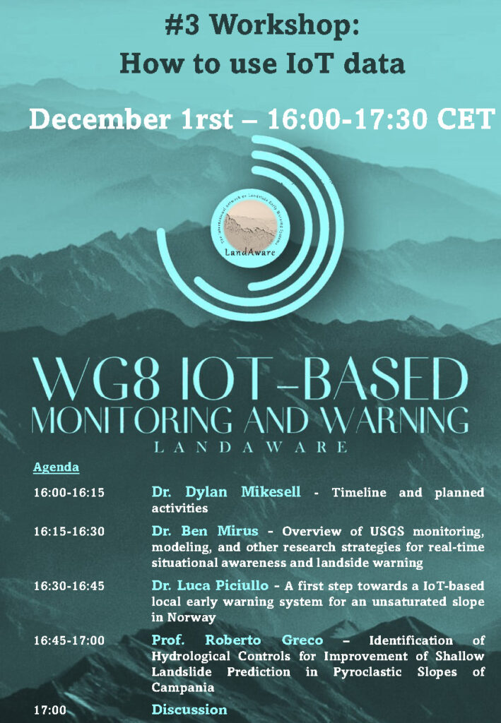
16:00-16:15 Dylan Mikesell (NGI, Norway) – Timeline and planned activities
16:15-16:30 Ben Mirus (USGS, USA) – Overview of USGS monitoring, modeling, and other research strategies for real-time situational awareness and landside warning
16:30-16:45 Luca Piciullo (NGI, Norway) – A first step towards a IoT-based local early warning system for an unsaturated slope in Norway
16:45-17:00 Roberto Greco (University of Campania, Italy) – Identification of Hydrological Controls for Improvement of Shallow Landslide Prediction in Pyroclastic Slopes of Campania
17:00 Discussion
Ben Mirus is a Research Geologist with the U.S. Geological Survey’s Landslide Hazards Program in Golden, Colorado. Ben applies his background in geology, hillslope hydrology, and numerical modeling towards developing new tools for landslide hazard assessment and loss reduction.
Luca Piciullo PhD at the University of Salerno, Italy, in Geotechnical engineering. Currently employed at the Norwegian Geotechnical Institute (NGI), Oslo, Natural Hazards division, in the section Slope stability and risk assessment. The technical and scientific work focuses on slope stability analysis, monitoring and risk mitigation with early warning systems, risk assessment of building damages due to deep excavations and tailings dams stability analysis.
Roberto Greco, Ph.D. in Hydraulic Engineering at Università di Napoli “Federico II” in 1997, professor of Hydrology and Hydraulic Infrastructures at Università della Campania “L. Vanvitelli”, teaching in the M.Sc. courses in Civil and Environmental Engineering. Since 2016, member of the Editorial Board of Hydrology and Earth System Sciences. The research activity deals with monitoring and modelling of water in natural and artificial systems, with specific focus on hillslope hydrology and landslides; preferential flows in unsaturated soils; environmental impact of sewer systems; management of water supply networks.
Workshop #2 was about real-time monitoring strategies for risk management. Three different case studies were presented by Emanuele Intrieri (University of Florence), Armin Dachauer (WSL), Claudia Meisina (University of Pavia).
If you are interested to have access to the past workshops material (presentations, recordings, flyers) please send an email to luca.piciullo@ngi.no
New paper published on Natural Hazards journal on real-time monitoring and modelling: “A first step towards a IoT-based local early warning system for an unsaturated slope in Norway” https://link.springer.com/article/10.1007/s11069-022-05524-3
The paper describes a framework for a IoT-based local landslide early warning system (Lo-LEWS). Monitoring, modelling, forecasting and warning represent the main phases of the proposed framework. In this study, the first two phases have been applied to capture the hydrological behaviour of a natural unsaturated slope located adjacent to a railway track in Eastern Norway.
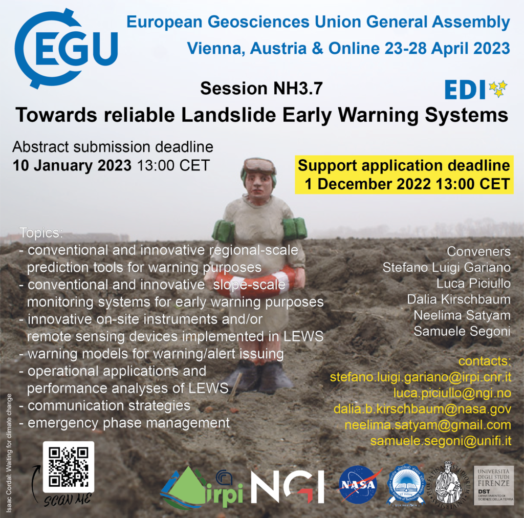
The session focuses on LEWSs at all scale (from local to regional) and stages of maturity (i.e., from prototype to active and dismissed ones). Test cases describing operational application of consolidated approaches are welcome, as well as works dealing with promising recent innovations, even if still at an experimental stage. The session is not focused only on technical scientific aspects, and submissions concerning practical and social aspects are also welcome.
Contributions addressing the following topics will be considered positively: – conventional and innovative slope-scale monitoring systems for early warning purposes – conventional and innovative regional prediction tools for warning purposes – innovative on-site instruments and/or remote sensing devices implemented in LEWS – warning models for warning/alert issuing – operational applications and performance analyses of LEWS – communication strategies – emergency phase management
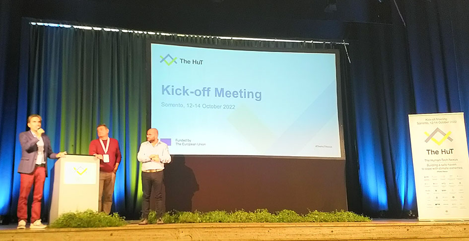
NEWS received from Manfred Stähli (Swiss Federal Research Institute WSL)
Today, the recently funded HORIZON-project The Hut(The Human-Tech Nexus – Building a Safe Haven to cope with Climate Extremes) kicks off at Sorrento (Italy) to leverage best practices and successful experiences to deal with the warning of various natural hazards. Ten demonstrators distributed across Europe will for the next four years constitute a muli-hazard arena wherein innovative risk-management tools will be tested and further developed. Several of these demonstrators (in Iceland, Spain, Italy and UK) will include the forecasting, warning and management of landslide events. LandAware is part of the Legacy advisory panel with the aim of linking to our network and forwarding specific information and good practices that are of specific relevance to the LandAware community. We will keep you updated!
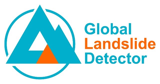
NEWS received from Catherine Pennington (British Geological Survey)
The British Geological Survey, the European-Mediterranean Seismological Centre and the Qatar Computing Research Institute have built a new Global Landslide Detector tool.
This machine learning tool extracts data automatically in 32 languages from social media in real-time, identifying landslides in photographs and placing them on the global map.
The tool is not intended to be used in isolation during a disaster scenario but could complement existing disaster workflows and provide new and timely data, taking into consideration the limitations described in the paper and data biases. It could also bring efficiency savings for data acquisition for landslide databases.
This first iteration of the tool involves more extensive model training experiments and a larger dataset than previous research.
Request for feedback:
The authors are asking the LandAware community to engage with the tool and feedback is requested on several elements including:
Expanding and refining the landslide keywords used to extract tweets
General feedback about the tool using the feedback form
Collaboration and engagement for future interations and applications
The paper: Pennington, C.V.L., Bossu, R., Ofli, F., Imran, M., Qazi, U.W., Roch, J. and Banks, V. (2022) A near-real-time global landslide incident reporting tool demonstrator using social media and artificial intelligence. International Journal of Disaster Risk Reduction, v 77, 103089, 14 pp. https://doi.org/10.1016/j.ijdrr.2022.103089
NEWS received from Mirianna Budimir (Practical Action, SHEAR)
We are pleased to share some collaborative resources on landslide early warning systems co-produced by the Science for Humanitarian Emergencies and Resilience (SHEAR) programme and LandAware: